
Maps in Tableau - Mapbox
For you all who wants to present regional sales to your collegues, team members or your boss, Tableau has its own default map whether you are using it with or without internet access. But when you are trying to have a more details maps like the street, buildings and other details on the map which Tableau so far does not provide much details for some non-US countries. Here I show you how it can be done with some easy steps only.
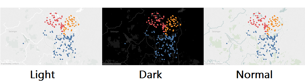
As you can see below are the default map style that Tableau provide:
If you want to have a more attractive map in the sense of color usage and more details like street or buildings but you do not know where you can get a non-charge service, you can go for Mapbox.
Firstly you will need a Mapbox account, it is free for sign up! With every account, Mapbox will provide us an API access token which can helps you to import the classic Mapbox map. Hence by copy and paste your API access token into correct box and choose the Mapbox preset map style that you prefer. Then Voila! Here is your map style that you choose just now!

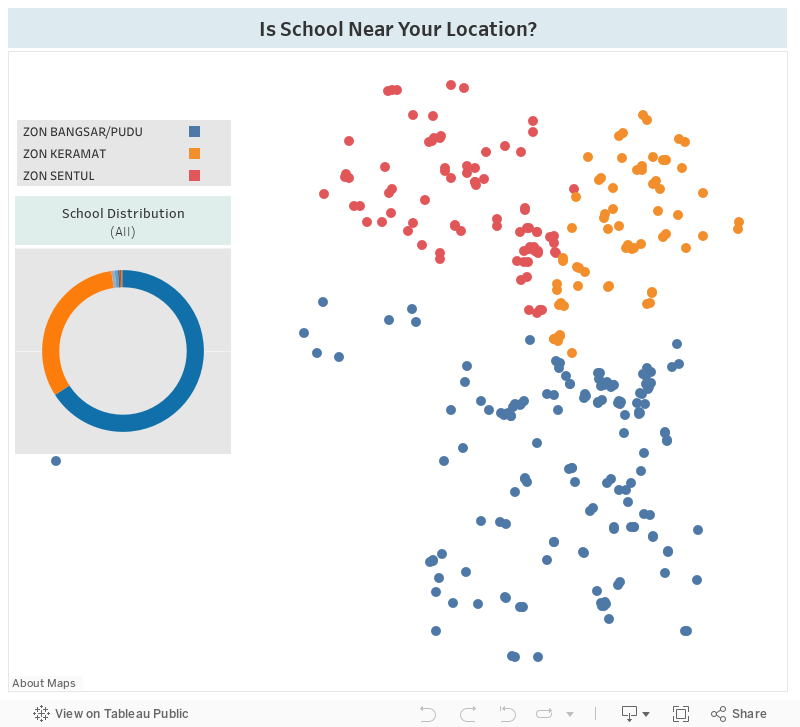
Below are the sample workbook which I have created by using Mapbox preset map. As you can try to scroll down for more details level where you are able to see the street details. Then the location of schools are determine by a list of latitude and longitude I have generate by myself. with the preset style of map and geographic details of each school, I can present a more details location map which contain street details on map.
Here also the other sample preset map from Mapbox:

I'm not here to do any advertisment, it is just sharing with you all so that you can know more about it.
You can get a free 14 trial days of Tableau Desktop 10 to know what answer you will find with you data!
Let us know if you need any demonstration or consultation by contact us!
Happy analysing!